Battle of Nashville & Beyond

  • Home
    • Resources
      • Franklin
      • Shiloh
    • About the Author
  • Tour Routes
    • Tour Route – 2 hours
    • Tour Route – 3 Hour
    • Tour Route – 6+ hours
  • Gunships vs Cavalry
    • Naval Battle Timeline
    • Brown Water Navy
    • The Gunboats of Nashville
      • Nashville Gunboats Photos
      • U.S.S. Cairo Virtual Tour
  • Kelley’s Point
    • Kelley’s Point Map
    • Kelley’s Point Naval Battle
    • 1936 Aerial Photo
    • Inset Zoom of Kelley’s Point
    • People of Interest
      • Le Roy Fitch
      • Mark Robertson Cockrill
      • Col. David C. Kelley
      • Richard W. Johnson
        • Battlefield Simulator
      • Hood’s Retreat
  • Blog
  • Hood’s Retreat
  • Virtual Battlefields
  • Athens-South Virtual Tours

April 6, 2017 By Bob Henderson 2 Comments

Shiloh in 360

Shiloh Battlefield Virtual Tour:  


1055 Pittsburg Landing Loop, Savannah, TN 38372

Update: 06APR17

peach-orchard-pano
Fraley Field: The Battle Begins

The Battle of Shiloh resulted in more casualties, than all of the previous United States military conflicts to date (23,746). It was a stunning shock to the nation, and a sobering lesson to the multitude of Americans that thought this was going to be a short affair.

In this major battle, Confederate Brevet Brigadier General Albert Sidney Johnston was the highest ranking officer killed in the American Civil War.  He was most likely hit by his own troops. His mortal leg wound was from the rear. Despite this calamitous setback, P.G.T. Beauregard was so confident after the first day of the battle, that he sent word back to Richmond that the Confederate forces had a complete and undisputed victory.

Cavalry Colonel Bedford Forrest knew better. At the close of the first day of battle, he pleaded with higher command to press the enemy into the night – or abandon the field altogether. His scouts had discovered a massive reinforcement flotilla landing from the Tennessee river that late afternoon.

The Shiloh Battlefield is one of the most well preserved battlefields of the American Civil War. It also contains Native American burial mounds. It’s remote location in rural Southwest Tennessee, lends itself to privacy unlike most other battlefields near populated areas.

Shiloh Battlefield: virtual tour

Fraley Field – Opening action at The Battle of Shiloh April 6, 1862

Peach Orchard

Bloody Pond 

Forrest 3rd Cavalry Regiment*

Hornet’s Nest

Water Oaks Pond

Indian Mounds

Shiloh Visitor Center

Confederate Burial Trench

Pittsburg Landing

National Cemetery


Note: get the full screen experience by clicking the icon in the lower left of the video frame. A zoom option is available also for reading the historical signage. Some markers are embedded in the floating icons. Panorama’s take a moment to load. They can also be viewed in a 360º viewfinder.

This content requires HTML5/CSS3, WebGL, or Adobe Flash Player Version 9 or higher.

See more 360º battlefields

Largest Civil War Battlefields: 

Chickamauga and Chattanooga National Military Park: 9,036 acres 

Fredericksburg and Spotsylvania: 8,374 acres

Pea Ridge 4,300 acres

Shiloh: 3,997 acres**

Gettysburg: 3,965 acres

Antietam: 3,230 acres


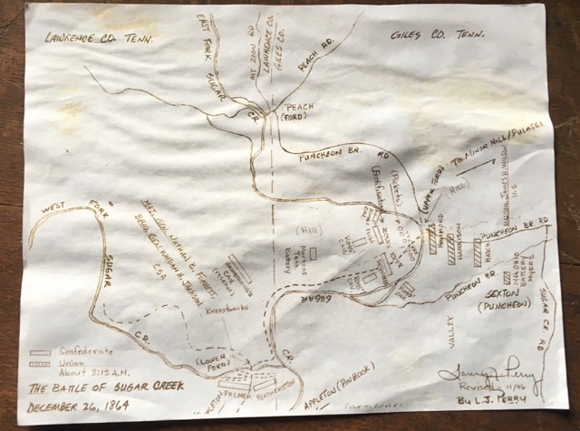
*Colonel Forrest 3rd Cavalry Regiment fought dismounted from just west of the Peach Orchard. This obscure marker in the virtual tour, is the only one of Forrest on the battlefield. Fallen Timbers, will soon be added to the park service, thanks to The Civil War Preservation Trust. That location is the site of a most impressive counter-charge by Forrest’s regiment during the retreat of the Confederate Army. The location will be dedicated April 6-9, 2017, during the 155th anniversary reenactment.

** The National Park Service is adding more land in the near future, including Fallen Timbers, Parkers Crossroads, Davis Bridge and more. This will make Shiloh the largest National Military Park in the country.


© Bob Henderson | Athens-South

#shiloh #civilwar #tn #virtualtour

Filed Under: Parks, Shiloh, Tennessee, The American Civil War, Virtual Tour

March 29, 2017 By Bob Henderson 2 Comments

Sugar Creek

The Battle of Sugar Creek | Hood’s Retreat

440 Appleton Road, Five Points, TN 38457


 In The Lion’s Mouth – by Derek Smith

“What followed over the next twelve days would be one of the most spellbinding and tragic episodes in American military history, as hunters and hunted left bloody footprints on the bayonet-sharp ice for more than 100 miles. Grizzled Confederates who survived claimed, it was worse than the patriots’ sufferings at Valley Forge. One general wrote ‘that it was a most painful march, characterized by more suffering than had ever before, been my misfortune to witness.’ ”

Sugar Creek was the last battle* of the Confederate Army of Tennessee – in Tennessee. It was fought on the Giles and Lawrence county line, near the Tennessee, Alabama border in late 1864. For ten bitter December days, and over one hundred miles, Lt. General Forrest defended Hood’s vanquished army, in a sequence of valiant rear-guard delaying actions, following the crushing rout at Nashville. From Brentwood, to Sugar Creek, Tennessee, these final desperate maneuvers, enabled the war-weary Confederates to break out, over the Tennessee River into Alabama. But the game would soon be up. The South would capitulate a few months later, ending the long bloody war between the States.

*the Battle of Bentonville, NC was the last battle of the Army of Tennessee before the Army was surrendered by Gen. Joseph is E. Johnston at Bennett Place near Durham Station, North Carolina.

Recommended Reading:

“Just before 8 A.M. on a cold winter morning, U.S. Gen. James H. Wilson’s cavalry corps advanced slowly through a thick fog. Forrest had stationed two brigades under Gen. Edward C. Walthall about 200 yards south of the creek’s main ford behind rock-and-log breastworks”… read more

The core battlefield of this last stand, is about 3 miles northwest of the Highway 11 bridge crossing at Sugar Creek. The battlefield is on private property, but can be viewed from several street views. The closest public perspective is on Puncheon Branch Road. PLEASE RESPECT PRIVATE PROPERTY HERE. This is not a public park.

This virtual tour is the final leg of that 100 mile battle. Tour points include the following historical Civil War sites in southern Giles & Lawrence County, Tennessee:

  • Appleton, TN at The Big Red Store
  • The Lower Ford
  • The Upper (Peach) Ford
  • Puncheon Branch Road
  • Sugar Creek Road
  • Dobbin’s Cemetery
  • Cemetery at Anthony Hill
  • Lytle-Noblit House

The Lytle-Noblit House

Dismantled in 2017

“Thomas H. Noblit (1812-1899), who served the community as justice of the peace, doctor, merchant, and farmer, built this log dogtrot farmhouse in the 1840s. The Civil War battle at Sugar Creek occurred nearby in December 1864. In the 1890s, his son-in-law, William Franklin “Will” Lytle (1858-1942), renovated the house in the Queen Anne style. Will’s daughter, Mary Will Lytle (1897-1990), was among Tennessee’s first women dentists.”

NOTE: The historical marker for this site disappeared around 2014, as well as the Sugar Creek marker a few miles away.

Take a 360 degree virtual tour of the battlefield land below:

This content requires HTML5/CSS3, WebGL, or Adobe Flash Player Version 9 or higher.


Battle Map Courtesy of Bob Boyd

The Big Red Store

440 Appleton Road, Five Points, TN 38457

The Big Red Store in Appleton, Tennessee is said to be the largest historic rural General Store in the country. It host’s several events during the year, including one on the 4th of July, and the anniversary of the Battle of Sugar Creek, each December 26th.

The event center is open by appointment only, and on special occasions. Contact Linda Boyd for details at (931) 556-2023. Admission is free, but donations are appreciated to help with restoration and upkeep of the building.

More battle sites on Hood’s Retreat

Chronology of General Hood’s Champaign

Reports from the Military Official Record

#sugarcreek

Filed Under: Cavalry, Forrest Cavalry, Hood, Preservation, Tennessee, Virtual Tour

March 24, 2017 By Bob Henderson Leave a Comment

Finding Landmarks

Finding Historical Civil War Landmarks in Tennessee


I love the Tennessee Civil War Trails tour. There are hundreds of sites that have been interpreted with great displays. The only problem, is there are no specific locations on this tour map. Sometimes I have found the road sign, but have been unable to find the interpretive pedestal associated with it. For example, there is a road marker on U.S. 31 for Hood’s Retreat near Richland Creek, but I have yet to find it’s tour point*. It may have been stolen. The Sugar Creek marker down the road disappeared a few years ago.

ArcGIS Content

I have found many historical sites not present on Google, the worlds largest digital map. Some them are fairly significant places. A few that I have listed are: the Corinth Earthworks (MS), Davis Bridge and the Sherman Reservation, just to name a few. As I travel around the state, I verify these places on Google Maps. If missing, I am able to get them listed (I am a Google Local Guide).  

There is a wonderful resource available that most travelers probably aren’t aware of. It’s a digital map called the Tennessee Civil War GIS Project. It’s a powerful digital map designed on ArcGIS. Some of the content are listed on the image to the right. There are subcategories with most of them. Best of all, for the traveler, it’s mobile friendly.

This is a powerful resource. It even includes narrative copy of the historical signs. The Civil War Trails icon references a PDF file, organized by county, that details the street address location of the site. I have yet to find the Richland Creek information, but I think this is not the norm. From what I can tell, it’s a very comprehensive database of historical sites in Tennessee.

Another great reference is the Historical Marker Database. It includes locations, maps, signage copy and photo’s of historical signs and interpretive displays.

  • Tennessee Civil War Trails PDF
  • Tennessee Civil War GIS Link
  • Historical Marker Data Base – Link


*Problem solved. The road sign points to the right down Kerr Hill Road. At the end take another right on Campbellsville Road, to Campbellsville, where the sign is clearly visible on the right.

Filed Under: Maps, Tennessee, The American Civil War

March 1, 2017 By Bob Henderson 1 Comment

Champ Ferguson

Confederate Guerrilla Raider: 

• Revised: 04 MAY 17 •

 
chain-ball
Ball and chain used during Champ Fergusion’s Trial • Tennessee State Museum

From the Tennessee Civil War Trails signage:

Champ Ferguson (1821-1865) was born in Kentucky, the oldest of ten children. He moved to White County, Tennessee, in the 1850s. During the Civil War, he showed passionate loyalty to the Southern cause and extreme hatred for the Union. The alleged reasons for his zeal range from a desire to settle longstanding grudges with local Unionists to revenge against the Union soldiers who he said raped his wife and daughter1 and killed his son2. Regardless of his motives, Ferguson was one of the most notorious Confederate guerrillas to roam the Upper Cumberland. He was most infamous for the Saltville Massacre, in which he supposedly directed the murders of several wounded and captured US. Colored Troops at Saltville, Virginia, in 1864. Federal officials arrested him after the war. He was convicted of 53 counts of murder, although he claimed to have killed more than 100 Union soldiers, insisting it was his military duty. Ferguson was sentenced to death by hanging. He requested that his body be taken to “White County, Tennessee, and be buried in good Rebel soil.” Ferguson is interred here in the cemetery named for the France family.

“I was a Southern Man at the start. I am yet, and will die a Rebel. I believe I was right in all I did . … I have killed a good many men, of course, I don’t deny that, hut I never killed a man whom I did not know was seeking my life …. I repeat that I die a Rebel out and out, and my last request is that my body he removed to White County, Tennessee, and he buried in good Rebel soil.” – Champ Ferguson, before his execution, 1865

Other Confederate veterans buried in France Cemetery include four brothers, all of whom died during the war: Sgt. Solomon Carmichael and Pvt. Thomas Carmichael (25th Tennessee Infantry), Pvt. Hance Carmichael (28th Tennessee Infantry), and Pvt. William L. Carmichael (8th Tennessee Cavalry).

Champ Ferguson Grave | France Cemetery | Calfkiller Highway (Hwy. 84)

Reports from Stokes Brigade, claimed that Champ was wounded in a skirmish near the Calfkiller River by the 5th Tennessee Cavalry.

Operations against guerrillas about Sparta February to April: Johnson’s Mills February 22, Sparta and Calfkiller River February 22, 1864. During this time frame, Captain Ferguson was accused of Murdering 19 men of the U.S. 5th Tennessee Cavalry.

Likely position of the February 22 engagement on the Calfkiller River near Long Hollow:

March 18, 1864 the 5th U.S. Cavalry attacked Confederate Colonel Hughes camp two miles from Beersheba Springs. This is most likely the location on the Collins River to the northwest of Beersheba Springs, near the base of the Cumberland Mountains:

Champ Ferguson: Confederate Guerilla and Jack Hinson’s One Man War

Emory & Henry College – Confederate Hospital

Footnotes:

1 After the war, Champ was put on trial for 53 murders. This included the execution of a Lt. Smith with the U.S. 13th Kentucky Cavalry, and 10 of his men. In testimony regarding his motivation, Champ denied that his wife and daughter had been molested. There is a strong suspicion that this was to protect their reputations.

2 According to Broomfield L. Ridley’s Battles and Sketches of the Army of Tennessee, published in 1906: “Champ was a citizen at his home when the tocsin was sounded, and stayed there until his own precincts were invaded. A rabid fire-eater past his house with a troop of blues. You ask why he was so desperate? It was told in camp that Champ Ferguson’s little three-year-old child came out onto the porch waving a Confederate flag. One of the men in blue leveled his gun at Champ and killed the child. Oh anguish! How the father’s heart bled! His spirit welled up like the indomitable will of a primitive Norsemen. In a moment of frenzy he said that the death of his baby would cost the “bluecoats” one hundred lives. And it did. One hundred twenty is believed to be the number he put to death (Comrade S.H. Mitchell got this from Champ himself.)”

#civilwar #guerrilla #champferguson

Filed Under: 360º, Cavalry, Tennessee

February 8, 2017 By Bob Henderson 2 Comments

Davis Bridge

Battle of Davis Bridge in Hardeman County, Tennessee 

Also know as the Battle of Hatchie Bridge

Wikipedia


October 5, 1862 | Southwest Tennessee

Maj. Gen. Earl Van Dorn vs Maj. Gen. Edward O.C. Ord

“By late spring 1862, United States forces in the West threatened to cut the Confederacy in two, having captured both New Orleans and Memphis on the Mississippi River, and the vital railroad hub at Corinth, Mississippi, thereby severing the Memphis & Charleston Railroad, the South’s only east-west connection linking the Atlantic to the Mississippi Valley. Efforts to complete the split stalled that summer when Union naval forces failed to capture Vicksburg, and the field armies struggled to control the vast territory occupied in the spring offensive. The Confederates seized on this lull to launch General Bragg’s invasion into Kentucky, and, in early October, sent an army to capture Corinth. However, repulsed there with heavy losses after two days of brutal fighting, this Southern force retreated back towards Davis Bridge on the Hatchie River in Hardeman County, Tennessee.

When the Southern Army blocked by Federals advancing from Bolivar, Tennessee, fierce fighting engulfed the crossing. The day-long conflict ended east of the river with the Confederates escaping to the south. The failure to retake Corinth proved the last Confederate offensive in Mississippi, as Union forces seized the initiative, and began a final relentless nine-months offensive to capture Vicksburg and take control of the Mississippi River”. – Davis Bridge Shiloh National Park 

This very remote battle site is actually part of the Shiloh Military Park over 30 miles to the east. It’s very hard to find, not marked from Highway 57.

Davis Bridge: 1145 Essary Springs Rd. Pocahontas, TN 38061

Metamora Hill: 1845 Pocahontas Rd. Pocahontas, TN 38061

This 3D like virtual tour covers three point os the Battlefield: the Hatchie River bridge site, cemetery and Metamora Hill.

This content requires HTML5/CSS3, WebGL, or Adobe Flash Player Version 9 or higher.


#davisbridge


Filed Under: 360º, Cavalry, Cemetery, Mississippi, Tennessee, Virtual Tour

  • « Previous Page
  • 1
  • …
  • 4
  • 5
  • 6
  • 7
  • 8
  • Next Page »
  • Facebook

Battlefield Trust

CWPT Link

Tennessee State Museum

DSC02614_5_6_7_8_opt

Fort Negley

Negely

USCT Charge on Peach Orchard Hill

USCT Painting

Travelers Rest

Travelers Rest

Belle Meade Plantation

Belle Meade Plantation

Battle of Franklin

Franklin

Nashville Naval Battle

Kelley’s Point Video

Nashville MIA’s

Copyright © 2026 · Bob Henderson. All rights reserved.