Battle of Nashville & Beyond

  • Home
    • Resources
      • Franklin
      • Shiloh
    • About the Author
  • Tour Routes
    • Tour Route – 2 hours
    • Tour Route – 3 Hour
    • Tour Route – 6+ hours
  • Gunships vs Cavalry
    • Naval Battle Timeline
    • Brown Water Navy
    • The Gunboats of Nashville
      • Nashville Gunboats Photos
      • U.S.S. Cairo Virtual Tour
  • Kelley’s Point
    • Kelley’s Point Map
    • Kelley’s Point Naval Battle
    • 1936 Aerial Photo
    • Inset Zoom of Kelley’s Point
    • People of Interest
      • Le Roy Fitch
      • Mark Robertson Cockrill
      • Col. David C. Kelley
      • Richard W. Johnson
        • Battlefield Simulator
      • Hood’s Retreat
  • Blog
  • Hood’s Retreat
  • Virtual Battlefields
  • Athens-South Virtual Tours

April 27, 2016 By Bob Henderson Leave a Comment

Resaca Battlefield

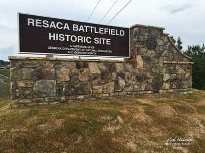
Resaca Battlefield Park Virtual Tour


6 Georgia 136, Resaca, GA 30175

resaca-sign

May 13, 2016

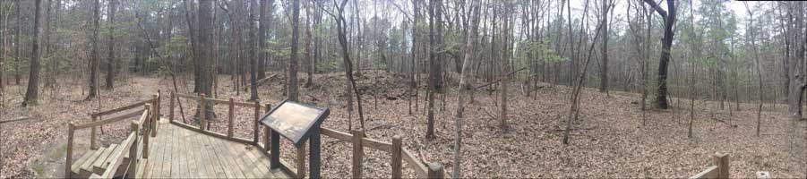
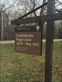
The newest American Civil War Battlefield to open soon. This 500+ acre 1864 battlefield park was part of the Atlanta Champaign, consisting of a running battle between Gen. Joe Johnston and Gen. Bill Sherman from just south of Chattanooga all the way to Atlanta. It’s complete with expansive walking trails, interpretive signage and a scenic picnic pavilion. In all, there is over 1,100 acres of battlefield preserved in Resaca, Georgia. Read more about the Battle of Resaca.

More details at the Friends of Resaca Battlefield

The Grand Opening dedication will be held on May 13, 2016 at 3:00 p.m. at the Resaca Battlefield Historic Site.

Cheval-de-frise-image
Cheval de frise at Resaca Battlefield Historic Site

See the 3D like virtual tour panorama’s below. May take a moment to load. Also available on Google Street View to use with a Google V/R viewer.

Note: get the full screen experience by clicking the icon in the lower left of the video frame.

This content requires HTML5/CSS3, WebGL, or Adobe Flash Player Version 9 or higher.

#resaca #civilwar #virtualtour

© Bob Henderson | Athens-South


Filed Under: Atlanta Champaign, Georgia, The American Civil War, Virtual Tour

April 24, 2016 By Bob Henderson Leave a Comment

The Red Clay Minuet

The Atlanta Champaign Virtual Tour 


“The Atlanta Campaign was a series of battles fought in the Western Theater of the American Civil War throughout northwest Georgia and the area around Atlanta during the summer of 1864. Union Maj. Gen. William T. Sherman invaded Georgia from the vicinity of Chattanooga, Tennessee, beginning in May 1864, opposed by the Confederate general Joseph E. Johnston.atlanta-400

Johnston’s Army of Tennessee withdrew toward Atlanta in the face of successive flanking maneuvers by Sherman’s group of armies. In July, the Confederate president, Jefferson Davis, replaced Johnston with the more aggressive John Bell Hood, who began challenging the Union Army in a series of damaging frontal assaults. Hood’s army was eventually besieged in Atlanta and the city fell on September 2, setting the stage for Sherman’s March to the Sea and hastening the end of the war.”      – Wikipedia

A running battle after the retreat of the Confederates at Missionary Ridge in the Battle of Chattanooga, these panoramas are some of the best preserved battlefields from that chapter of the war. In sequence from North Georgia to Atlanta:

Note: get the full screen experience by clicking the icon in the lower left of the video frame. A zoom option is available also for reading the historical signage. Some markers are embedded in the floating icons.

This content requires HTML5/CSS3, WebGL, or Adobe Flash Player Version 9 or higher.

#atlanta #civilwar #virtualtour

Tunnel Hill (admission fee) – 215 Clisby Austin Drive, Tunnel Hill, GA 30755 (to be re-shot)

Rocky Face – 2401 Chattanooga Road, Dalton, GA 30720

Dug Gap 1 – Dug Gap Mountain Rd, Dalton, GA 30720 (34.742882, -85.015281)

Dug Gap 2 – (34°44’51.2″N 85°00’56.3″W)

Resaca Battlefield Historic Site – Resaca Lafayette Rd NW, Resaca, GA 30735

Etowah Furnace – Altoona – 1052 Old River Road SE, Cartersville, GA 30121

Pickett’s Mill – 4432 Mount Tabor Church Road, Dallas, GA 30157 (Open Thursday- Saturday)

Kennesaw Mountain – 900 Kennesaw Mountain Dr, Kennesaw, GA 30188 – tour

Peachtree Creek – 482-488 Collier Rd NW, Atlanta, GA 30309 – tour 

The History of the American Civil War in Georgia. Narrated by Hal Holbrook.

“The Battle for Georgia – a History of The Civil War in Georgia” is a 24 Minute educational documentary commissioned by SMMA and produced by Stone Mountain Productions, Inc. The award winning film is narrated by Hal Holbrook and features hundreds of archival photographic images from the Civil War.

Recommended Reading:

© Bob Henderson | Athens-South


Filed Under: Atlanta Champaign, Georgia, Hood, The American Civil War, Virtual Tour Tagged With: Atlanta Champaign

April 1, 2016 By Bob Henderson Leave a Comment

Earthworks in 3D

Corinth, MS Civil War Earthworks Virtual Tour: 


Corinth Interpretive Center: 501 W Linden St, Corinth, MS 38834

earthworks-corinth-panorama

I recently visited one of the newest jems on the American Civil War history trail. Corinth, Mississippi has one of the newest and best interpretive centers I have seen in the western theater territory (West Linden Street). It also has some of the most well preserved earthworks. It’s literary quite a hike to get to at about a mile and a half. The entrance I used was at 3101 N Polk St, Corinth, MS 38834. It was gated at the time, so I used my mountain bike to reach the trail head (1 mile). From there, it’s about a half mile to the north rim of the Corinth earthworks. #earthworks #3dcss-earthworks-image

Trail Head Coordinates to Confederate Siege Works:

 34°57’43.70″N 

88°30’58.43″W

An affordable way to view these on your smart phone is with the Google Cardboard 3D viewer. It sells for only $15. The Google Street View App is free.


Note: get the full screen experience by clicking the icon in the lower left of the video frame. A zoom option is available also for reading the historical signage. Some markers are embedded in the floating icons.

This content requires HTML5/CSS3, WebGL, or Adobe Flash Player Version 9 or higher.

more tours

Suggested Reading:


#corinth #civilwar #earthworks #ms

© Bob Henderson | Athens-South


earthworks-sign-image


See more VR battlefields

Photography by Bob Henderson

Filed Under: Corinth, Mississippi, The American Civil War, Virtual Tour

March 18, 2016 By Bob Henderson Leave a Comment

Captured: Battlefield Shrugged

Preserving Battlefields Forever in 360º: 


4442 Tennessee 6, Thompson Station, Tennessee

Hood’s Retreat at Thompson’s Station

This content requires HTML5/CSS3, WebGL, or Adobe Flash Player Version 9 or higher.

#hoodsretreat


google-street-viewWest Harpeth River – Dec. 17, 1864

Marker ID: THC 3D 17 

Location: U.S. 31, Williamson County, south of Franklin, TN on the West Harpeth River (360° panorama)

“Moving rapidly south through Franklin, Stephen D. Lee’s Corps, with Chalmers’ cavalry division attacked, took up a delaying position in this area about 1:00 p.m. They beat off attacks by Wood’s IV Corps & Wilson’s cavalry. Here, Gen. Lee was wounded; command passed to Maj. Gen. L. Carter Stevenson. The Army of Tennessee bivouacked that night around Spring Hill.”

More Battlefields in Tennessee

360 Photographic Services provided by Athens-South.com

Contact me for more information on my photography.  I am an Certified Trusted Google Street View Photographer. 

An affordable way to view these on your smart phone is with the Google Cardboard viewer. It sells for only $15.

Recommended Reading:

Filed Under: Cavalry, Forrest Cavalry, Hood, The American Civil War, Virtual Tour

January 29, 2016 By Bob Henderson Leave a Comment

Old City Cemetery

The Nashville Old City Cemetery 

A Virtual Tour of the Old City Cemetery in Nashville including the grave of “Old Glory” William Driver.

“In order to save the flag from further threats, Driver (aided by loyal women neighbors) had it sewn into a coverlet and hidden until late February 1862, when Nashville fell to Union forces. When the Union Army (led by the 6th Ohio Infantry) entered the city, Driver went to Tennessee State Capitol after seeing the American flag and the 6th Ohio’s regimental colors raised on the Capitol flagstaff.” …read more

This content requires HTML5/CSS3, WebGL, or Adobe Flash Player Version 9 or higher.

Readings:

#oldcitycemetery


Filed Under: Cemetery, Nashville, Virtual Tour

  • « Previous Page
  • 1
  • …
  • 23
  • 24
  • 25
  • 26
  • 27
  • 28
  • Next Page »
  • Facebook

Battlefield Trust

CWPT Link

Tennessee State Museum

DSC02614_5_6_7_8_opt

Fort Negley

Negely

USCT Charge on Peach Orchard Hill

USCT Painting

Travelers Rest

Travelers Rest

Belle Meade Plantation

Belle Meade Plantation

Battle of Franklin

Franklin

Nashville Naval Battle

Kelley’s Point Video

Nashville MIA’s

Copyright © 2025 · Bob Henderson. All rights reserved.